
Girton, Cambridge is a civil parish and historic village situated two miles northwest of Cambridge city centre in Cambridgeshire, England. It provides a quiet residential environment while maintaining immediate proximity to urban research parks, technology hubs, and university institutions.
- What Is the Historical Context of Girton, Cambridge?
- How Is Girton, Cambridge Structured and Structured Geographically?
- How Do Transport Links Connect Girton, Cambridge to the City Centre?
- Why Is Girton College Significant to the Village and University?
- What Property Types and Living Environment Does Girton Offer?
- What Amenities and Community Services Are Available in Girton?
- What Is the Future Outlook for Development in Girton, Cambridge?
- Frequently Asked Questions
Girton spans approximately 1,691 acres of land. It functions as a rural transition zone between the urban density of central Cambridge and the agricultural expanse of the South Cambridgeshire district. The village combines historic rural architecture, residential housing developments, and academic facilities affiliated with the University of Cambridge.
The geography of Girton is defined by its flat topography along the edge of the East Anglian Fens. It lies predominantly on a bed of Gault Clay overlaid by river terrace gravels. The settlement pattern includes an elongated main street, designated historic ends such as Duck End, and modern housing built to accommodate expanding regional employment.
As an administrative unit, Girton operates under the South Cambridgeshire District Council and Cambridgeshire County Council. The village retains independent community services including a parish council, primary schooling, recreation grounds, local retail establishments, and historic public houses.
What Is the Historical Context of Girton, Cambridge?
Girton began as an Anglo-Saxon agricultural settlement established prior to the eleventh century. Archaeological investigations confirm Roman activity along the Via Devana, the ancient Roman road now known as Huntingdon Road, which forms the southern boundary of the parish.
The Domesday Book of 1086 records the village under the name Grantebrige hundred, documenting 32 peasant landholders and two serfs dependent on local manorial land holdings. The name Girton derives from Old English terms meaning a farmstead or settlement built on gravel ground, reflecting the underlying geology of the area.
Throughout the Middle Ages, Girton remained a small agrarian community centered on open-field farming systems. Tax assessments from 1377 indicate 196 adult residents, though plague and agricultural shifting caused population contraction in the sixteenth century. Parliamentary enclosure in the early nineteenth century altered the land layout, establishing defined farm boundaries and enclosed fields.
The fundamental transformation of Girton occurred in 1873 when Girton College relocated to the parish. Founded in 1869 in Hitchin by Emily Davies and Barbara Bodichon as the first residential higher education college for women in Great Britain, its relocation anchored the village to the academic growth of Cambridge. Suburban residential development expanded rapidly along Huntingdon Road throughout the twentieth century.
How Is Girton, Cambridge Structured and Structured Geographically?
Girton is structured around a central linear roadway, High Street, which branches into secondary residential avenues, historical lanes, and surrounding arable farmland. The parish layout contains several distinct geographic zones that serve specific residential, educational, and agricultural purposes.
The northern section encompasses the historic core of the original village, containing St Andrew Church, traditional timber-framed cottages, and preserved green spaces. The southern area borders Huntingdon Road and connects directly with the Eddington development, a modern extension of the University of Cambridge containing academic accommodation, public parks, and primary facilities.
Residential structures within Girton include 18th-century thatch and clunch cottages, mid-20th-century brick housing estates, and contemporary eco-designed apartment complexes. The western boundary borders open agricultural fields, creating a defined edge between built environment and rural countryside.
Key structural components include:
- Educational institutions such as Girton Glebe Primary School and Girton College.
- Recreational spaces including the Girton Recreation Ground, pavilion, and local allotments.
- Community nodes including the village hall, local shops, and public houses.
How Do Transport Links Connect Girton, Cambridge to the City Centre?
Girton connects to Cambridge city centre and regional transport networks via primary arterial roadways, dedicated cycleways, and public bus services. The transport infrastructure is designed to accommodate commuter traffic toward central academic departments and regional business parks.
Huntingdon Road serves as the main vehicular route connecting Girton directly to the Cambridge Inner Ring Road. The A14 dual carriageway runs adjacent to the northern perimeter of the parish, providing direct road transit to the M11 motorway, Stansted Airport, and the broader East Anglian road infrastructure.
Public transport operates through regular bus services, including the Universal U-bus route funded in part by the University of Cambridge. This bus service connects Girton and the nearby Eddington hub directly to West Cambridge sites, the city centre, and the Cambridge Biomedical Campus.
Cycling infrastructure features dedicated, segregated cycle paths along Huntingdon Road, allowing commuters to reach central market square locations in approximately 15 minutes. Cambridge North railway station sits four miles east, providing direct rail transport to London King’s Cross and Liverpool Street stations.
Why Is Girton College Significant to the Village and University?
Girton College is significant because it was established as Great Britain’s first residential higher education college for women, establishing a historic precedent for gender equality in academic institutions. The institution holds full collegiate status within the University of Cambridge.
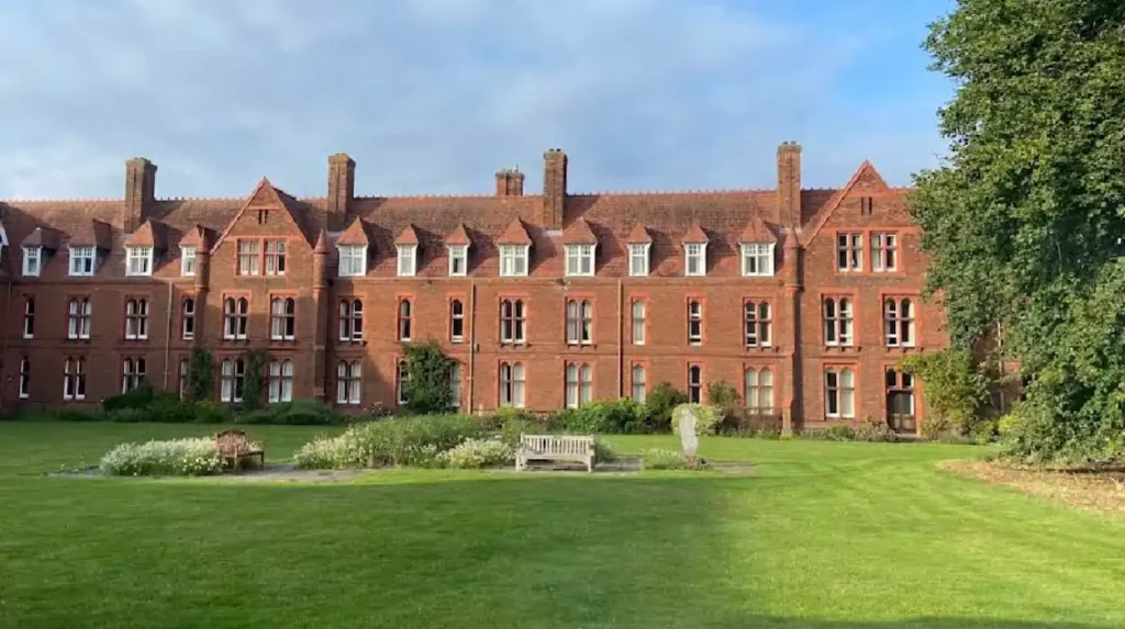
Designed by architect Sir Alfred Waterhouse, the main college buildings feature distinctive Victorian red-brick architecture, entrance towers, and extensive internal courtyards built between 1873 and 1886. The college grounds cover 50 acres of cultivated gardens, orchards, woodlands, and sports fields located along Huntingdon Road.
In 1948, the University of Cambridge granted full degree-conferring status to women, formalizing Girton’s full membership in university governance. In 1976, Girton became the first previously all-female Cambridge college to admit male undergraduates, establishing a co-educational policy.
The college operates as a key local employer and cultural site within the parish. It houses specialized research archives, the Lawrence Room museum featuring Anglo-Saxon and Egyptian artifacts, and public performance spaces used for regional artistic events.
What Property Types and Living Environment Does Girton Offer?
Girton offers a varied housing stock that spans multiple centuries of architectural design, serving permanent residents, academic staff, and student populations. The living environment combines suburban quietness with direct urban accessibility.
The property market contains early 19th-century brick cottages, mid-century detached and semi-detached family homes, and 21st-century energy-efficient housing developments. Recent expansion around the Eddington fringe has introduced high-density apartment blocks built to sustainable code standards.
Housing categories available in the parish include:
- Single-family detached homes with large private gardens along Cambridge Road and Pepper Rocks.
- Semi-detached suburban housing built during the mid-20th century along Thornton Road.
- Historic listed properties concentrated along Church Lane and the High Street core.
The residential demographic consists of university employees, technology sector professionals from nearby Cambridge Science Park, retired residents, and university students. The presence of strict greenbelt planning protections around South Cambridgeshire limits excessive suburban sprawl, maintaining the village boundary.
What Amenities and Community Services Are Available in Girton?
Girton provides essential public services, commercial amenities, and community facilities designed to maintain local independence from the city centre. These resources support daily residential needs within walking distance of primary housing areas.
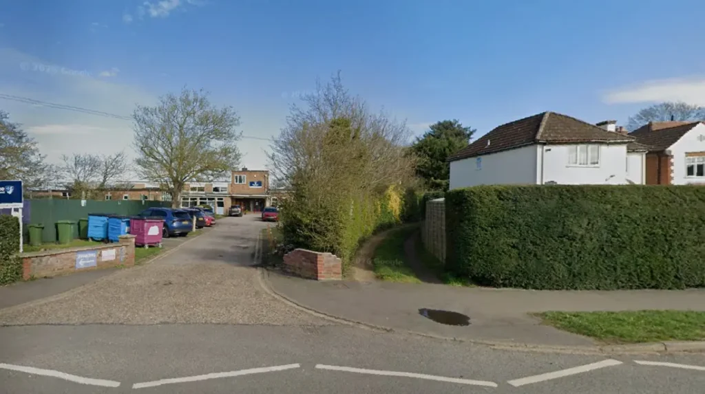
Educational needs are served by Girton Glebe Primary School, an state-funded primary institution feeding into secondary academies such as Impington Village College. Early years education is provided by local pre-school facilities and nurseries located near the village center.
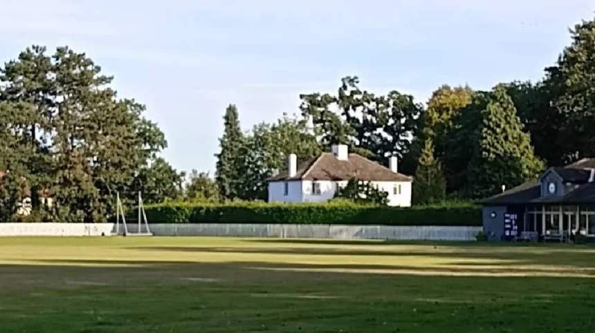
Commercial amenities include local convenience stores, a post office counter, a pharmacy, and traditional public houses such as The George. The local recreation ground includes tennis courts, football pitches, a cricket pavilion, a sensory garden, and a modern children’s play area.
Medical and healthcare services are supported by nearby GP surgeries in neighbouring Histon and Huntington Road practices. Community organizations operate out of the Girton Village Hall and William Collyn Community Centre, which host sports clubs, educational workshops, and local governance meetings.
What Is the Future Outlook for Development in Girton, Cambridge?
The future outlook for Girton involves managing growth pressures driven by the Cambridge technology sector while preserving historic parish identities and environmental greenbelt boundaries. Regional infrastructure planning guides development strategies across South Cambridgeshire.
Sustainable housing expansions will continue around the North West Cambridge Development masterplan area, integrating smart infrastructure, district heating, and expanded public transport routes. These developments aim to absorb regional housing demand without compromising the historic character of Girton’s village core.
Environmental management strategies focus on preserving biodiversity across local green spaces, agricultural field margins, and natural drainage channels. Community initiatives prioritize carbon-reduction programs, enhanced cycling routes, and the protection of historic tree preserves across the parish.
Economic integration with the surrounding Cambridge cluster ensures that Girton will remain an important residential area for research, technology, and academic professionals. Managed planning controls aim to balance infrastructural growth with rural village conservation.
Frequently Asked Questions
How far is Girton from central Cambridge?
Girton is located approximately two miles northwest of Cambridge city centre. Commuters can reach the city centre in 15 minutes by bicycle or 20 minutes using local bus routes along Huntingdon Road.
What is Girton College famous for?
Girton College is famous for being Great Britain’s first residential higher education college for women, founded in 1869. It became co-educational in 1976 and is recognized for its 50 acres of historic gardens and red-brick architecture.
Does Girton have good public transport links?
Yes, Girton features regular bus services, including the Universal U-bus route connecting to central Cambridge, West Cambridge sites, and the Biomedical Campus. Dedicated cycle pathways along Huntingdon Road provide safe bike transit.
Is Girton a good place for families to live?
Girton offers an ideal living environment for families due to its quiet village atmosphere, local green spaces, low traffic, and primary education options like Girton Glebe Primary School. It combines rural charm with city accessibility.
What housing options exist in Girton village?
Housing options range from 18th-century historic cottages and mid-century family houses to modern eco-friendly apartments near Eddington. Planning policies help preserve the distinct balance between rural countryside and residential growth.