Navigating Cambridge without a car requires combining active cycling infrastructure with high-frequency public transit networks across the city. Travellers utilise over 80 miles of dedicated cycleways, the 16-mile Cambridgeshire Guided Busway, regional rail links, and five Park and Ride sites.
- Why Is Cambridge Designed for Car-Free Travel?
- How Does the Cambridge Cycling Network Operate?
- What Public Bike Hire and E-Scooter Schemes Are Available?
- How Do Local Bus Services and the Guided Busway Work?
- How Can Travellers Use the Five Cambridge Park and Ride Sites?
- What Rail Connections Serve Cambridge Without a Car?
- How Walkable Is Central Cambridge for Pedestrians?
- What Apps and Payment Systems Streamline Car-Free Navigation?
Cambridge operates as the premier cycling and low-emission transport hub in the United Kingdom. Local authorities actively restrict private motor vehicle access within the historic medieval street network to prevent severe gridlock and protect air quality.
The Greater Cambridge Partnership and Cambridgeshire County Council enforce modal filters, rising bollards, and pedestrianised zones across the city centre. Consequently, walking, cycling, and public buses move commuters and tourists faster than private automobiles during peak hours.
Understanding the spatial layout of the River Cam bridges, radial arterial roads, and peripheral transit interchanges enables seamless car-free mobility throughout the region.
Why Is Cambridge Designed for Car-Free Travel?
Cambridge restricts private cars because its medieval street grid cannot accommodate modern motor traffic volumes without causing severe congestion. Local transport authorities prioritise sustainable mobility, resulting in 45 percent of residents commuting by bicycle and over 20 percent using public transit.
The historic core of Cambridge dates back to the Roman settlement of Duroliponte and expanded around medieval university colleges founded from 1209 onwards.
Narrow thoroughfares such as King’s Parade, Trinity Street, and Sidney Street lack the physical width required for multi-lane vehicular traffic or extensive roadside parking. In 1997, Cambridgeshire County Council introduced the Core Traffic Scheme, installing automated rising bollards on key central arteries to block through-traffic.
This regulatory framework divided the city centre into distinct traffic cells accessible only to buses, taxis, emergency vehicles, and cyclists.
Today, the Greater Cambridge Partnership administers the City Access programme to further reduce carbon emissions and improve urban air quality. According to the 2021 United Kingdom Census conducted by the Office for National Statistics, Cambridge records the highest cycling modal share in England and Wales.
Over 45 percent of working residents travel to their workplace by bicycle, compared to the national average of 2 percent. Furthermore, residential parking permits are strictly rationed, and central multi-storey car parks charge premium hourly tariffs exceeding £3.50 per hour to discourage private vehicle entry.
How Does the Cambridge Cycling Network Operate?
The Cambridge cycling network operates through 80 miles of segregated cycle paths, shared-use riverside routes, and priority junctions. Cyclists utilise flat terrain, Dutch-style roundabouts, and dedicated cycle bridges over the River Cam to traverse the city within 15 minutes.
Cambridge sits on the edge of the East Anglian Fens, providing completely flat topography that makes cycling accessible to riders of all fitness levels. The local cycle network connects outer suburbs like Chesterton, Cherry Hinton, and Trumpington directly to the central market square and university departments.
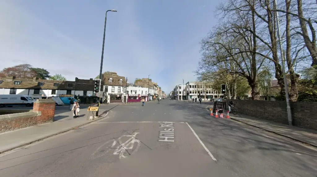
Key arterial routes include the Chisholm Trail, a north-south walking and cycling corridor linking Cambridge North railway station to Cambridge railway station via the Abbey-Chesterton Bridge. Another vital corridor is the Hills Road segregated cycleway, which features physical kerbs separating bicycles from motorised traffic.
In July 2020, Cambridgeshire County Council opened the Fendon Road roundabout, the first Dutch-style roundabout in the United Kingdom.
This junction gives orbital priority to cyclists and pedestrians over entering and exiting motor vehicles, reducing collision risks at busy intersections.
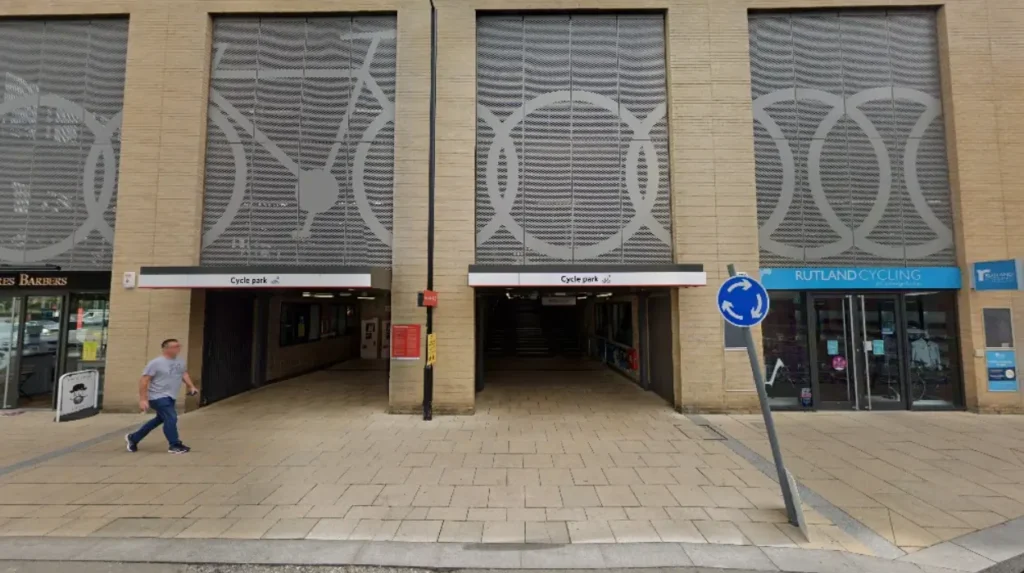
The city also enforces strict cycle parking regulations, providing over 10,000 public cycle racks alongside the 2,850-space CyclePoint multi-storey bicycle hub at Cambridge railway station. Riders must equip bicycles with white front lights, red rear lights, and rear reflectors when riding after sunset under the Road Vehicles Lighting Regulations 1989.
What Public Bike Hire and E-Scooter Schemes Are Available?
Visitors access short-term micromobility in Cambridge through the Voi dockless e-bike and e-scooter scheme alongside traditional local cycle hire shops. Riders unlock electric vehicles via a smartphone application, paying a £1 unlock fee plus per-minute usage rates within designated operating zones.
Cambridgeshire and Peterborough Combined Authority partners with Voi Technology to operate the official micromobility trial across Cambridge. The fleet includes coral-coloured electric bicycles and electric scooters equipped with geofencing technology.
Geofencing automatically restricts vehicle speeds to 8 miles per hour in slow-speed zones and disables parking in prohibited heritage areas like Parker’s Piece or Senate House Hill. Users must hold a valid provisional or full driving licence to rent Voi e-scooters, whereas Voi e-bikes require no driving licence and accept riders aged 16 and above.
For multi-day rentals, independent local retailers such as Station Cycles, City Cycle Hire, and Rutland Cycling supply standard hybrid bicycles, folding Brompton bikes, and cargo bikes. Daily rental rates for a standard three-speed city bicycle average between £15 and £25, inclusive of a helmet and a D-lock.
Travellers must secure rented bicycles to fixed Sheffield stands using heavy-duty hardened steel locks, as Cambridgeshire Constabulary reports high rates of opportunistic cycle theft in unsecured zones.
How Do Local Bus Services and the Guided Busway Work?
Local bus services operate primarily through Stagecoach East and Whippet, anchored by the 16-mile Cambridgeshire Guided Busway. Buses run on concrete guideways separated from road traffic, delivering passengers from St Ives and Trumpington into central Cambridge without traffic delays.
The Cambridgeshire Guided Busway opened in August 2011 and remains the longest guided busway in the world. Specially adapted buses feature horizontal guide wheels attached to the front axles that engage with raised concrete kerbs along the track.
This engineering mechanism allows buses to travel at speeds up to 56 miles per hour along former railway alignments, completely bypassing road congestion on the A14 and M11 corridors.
The northern section connects St Ives, Histon, and Cambridge Science Park to the city centre, while the southern section links Cambridge railway station to Addenbrooke’s Hospital and Trumpington.
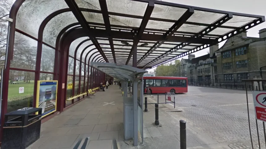
Standard urban bus routes, branded as the Citi network by Stagecoach East, radiate from the Drummer Street bus station and Emmanuel Street stops. Key routes include Citi 1 connecting Arbury to Fulbourn, Citi 2 linking Milton to Addenbrooke’s, and Citi 3 serving Cherry Hinton.
Under the Cambridgeshire and Peterborough Combined Authority Tiger Pass initiative, passengers aged under 25 travel on any local bus service for £1 per single journey. Standard adult single fares are capped at £2 under the national Department for Transport bus fare cap scheme, payable via contactless bank cards or the Stagecoach smartphone app.
How Can Travellers Use the Five Cambridge Park and Ride Sites?
Travellers use five peripheral Park and Ride sites located at Madingley Road, Trumpington, Babraham Road, Newmarket Road, and Milton to leave cars outside the city. Dedicated electric double-decker buses depart every 10 to 15 minutes, reaching central Cambridge within 15 minutes.
The Cambridge Park and Ride network intercepts private motor vehicles at major motorway and trunk road junctions before they enter the urban boundary. Each facility offers free parking for up to 18 hours, covered bicycle lockers, and electric vehicle charging bays.
Stagecoach East operates zero-emission electric double-decker buses on all five routes, running seven days a week from 07:00 until 20:30 Monday to Saturday and 09:00 until 18:00 on Sundays.
A standard Park and Ride return bus ticket costs £3.50 per adult, and up to three children aged under 16 travel free with a fare-paying adult. Group tickets accommodate up to five people travelling together for £8.50.
Because Park and Ride buses utilise dedicated bus lanes on Madingley Road, Hills Road, and Newmarket Road, they maintain strict timetable reliability even during peak morning and evening commuter rush hours.
What Rail Connections Serve Cambridge Without a Car?
Cambridge connects to London and regional hubs via three railway stations: Cambridge, Cambridge North, and Cambridge South. Frequent trains operated by Great Northern, Greater Anglia, and CrossCountry reach London King’s Cross in 48 minutes and London Liverpool Street in 70 minutes.
Cambridge railway station sits one mile southeast of the historic city centre on Station Road. It functions as a major regional interchange served by four train operating companies: Great Northern, Greater Anglia, CrossCountry, and Thameslink.
Non-stop express services run every 30 minutes to London King’s Cross, while stopping services connect directly to Gatwick Airport, Brighton, Ely, Norwich, Ipswich, and Birmingham New Street.
Passengers exit the station directly onto the Station Square interchange, which features covered bus shelters, taxi ranks, and immediate access to the Guided Busway.
Opened in May 2017, Cambridge North railway station serves the northern technology clusters, including Cambridge Science Park and St John’s Innovation Centre. It sits directly on the Chisholm Trail cycle route and the Guided Busway network, allowing seamless multimodal transfers without entering central traffic.
Construction on the new Cambridge South railway station near the Cambridge Biomedical Campus expands rail capacity further, providing direct rail access for hospital staff, medical researchers, and patients travelling to Addenbrooke’s Hospital and Royal Papworth Hospital.
How Walkable Is Central Cambridge for Pedestrians?
Central Cambridge is compact and highly walkable, allowing pedestrians to cross the entire historic core from Magdalene Bridge to Downing Street in 20 minutes. Wide paved footpaths, pedestrianised market squares, and riverside meadow trails provide safe, traffic-free walking corridors.
The primary retail and historic districts of Cambridge span less than one square mile, making walking the most efficient mode of transport between university colleges, museums, and shopping arcades.
Key pedestrianised zones include Market Hill, Petty Cury, Lion Yard, and Rose Crescent, where motor vehicles are prohibited between 10:00 and 16:00 daily. Footpaths along the Backs, running parallel to the River Cam behind King’s College, Clare College, and Trinity College, offer scenic pedestrian routes connecting Queens’ Green to Magdalene Street.
For leisure walking, the River Cam towpath stretches continuously from Jesus Green through Stourbridge Common and Ditton Meadows out to the villages of Fen Ditton and Horningsea.
Pedestrians share several towpath sections and the Garret Hostel Bridge with cyclists, requiring walkers to keep to the left and remain alert for bicycle bells. Tactile paving, dropped kerbs, and audible pedestrian crossings at major junctions such as Hyde Park Corner and Mitcham’s Corner ensure step-free accessibility for wheelchair users and pushchairs.
What Apps and Payment Systems Streamline Car-Free Navigation?
Travellers streamline car-free navigation in Cambridge using contactless bank cards alongside four primary mobile applications: Stagecoach Bus, Voi, Trainline, and CycleStreets. These digital tools provide live bus tracking, dockless bike unlocking, mobile rail ticketing, and cycle-specific turn-by-turn routing.
Contactless payment technology eliminates the need to carry cash across all Cambridge public transport networks. Buses operated by Stagecoach East and Whippet accept contactless Visa, Mastercard, Apple Pay, and Google Pay readers upon boarding, automatically calculating daily fare caps when passengers tap on with the same device.
Rail passengers travelling between Cambridge and London Stansted Airport or London terminals use digital barcodes stored within the Trainline, Greater Anglia, or Great Northern apps to pass through automated ticket barriers.
For route planning, the Cambridge-developed CycleStreets application calculates bicycle routes tailored to rider confidence, offering options for fastest, balanced, or quietest backstreet paths. Meanwhile, the MyBusTrip and Stagecoach apps display real-time GPS vehicle locations on interactive city maps, alerting commuters to service diversions or exact arrival times at over 600 local bus stops.
How do you get from Cambridge train station to the city centre without a car?
Travellers reach the city centre from Cambridge railway station in 10 minutes using Citi 1, Citi 3, Citi 7, or the Guided Busway U route from Station Square. Alternatively, pedestrians walk straight down Hills Road and Regent Street in 20 minutes, or hire a Voi e-bike outside the main concourse for a 6-minute ride.
Is Cambridge safe for beginner cyclists?
Cambridge provides safe cycling conditions for beginners due to its completely flat terrain, 80 miles of segregated cycle paths, and widespread driver awareness. New riders should stick to off-road routes like the Chisholm Trail, Midsummer Common, and the Guided Busway maintenance track before navigating busy central junctions like Hyde Park Corner.
Can you use an Oyster card on Cambridge buses and trains?
Transport for London Oyster cards do not work on Cambridge buses or regional rail services to Cambridge. Passengers must instead purchase paper tickets, use mobile rail apps, or pay directly with contactless debit cards, credit cards, Apple Pay, or Google Pay on local buses and at station ticket barriers.
What is the cheapest way to travel around Cambridge without a car?
Walking across the compact one-square-mile city centre is completely free and covers most major university colleges and museums. For longer suburban journeys, local buses cost £2 per single adult trip under the national fare cap, while residents under age 25 pay £1 per journey using a Tiger Pass.
Are bicycles allowed on trains to and from Cambridge?
Full-sized non-folding bicycles are allowed free of charge on Greater Anglia, Great Northern, and CrossCountry trains outside peak weekday commuter hours. During peak periods—typically 07:00 to 09:30 arriving in Cambridge or London and 16:00 to 19:00 departing—only fully folded bicycles are permitted on board.