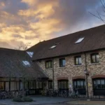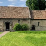

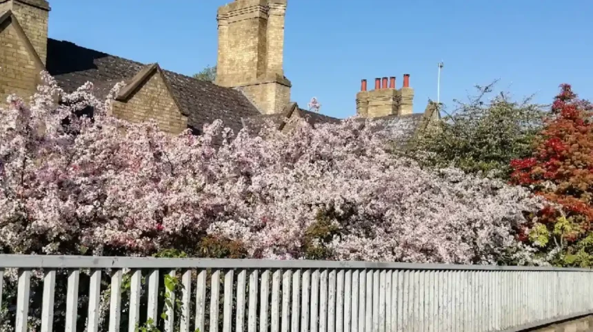
Arbury contains a high density of archaeological remains that confirm continuous human occupation from the Iron Age through the Roman period. The area served as a vital agricultural, domestic, and burial landscape closely linked to the Roman settlement at Duroliponte.
- Prehistoric Origins and the Iron Age Landscape
- The Roman Settlement and Duroliponte
- Archaeological Discoveries and Artefacts
- Where can visitors see the Roman heritage of Arbury?
- The Museum of Archaeology and Anthropology
- The Arbury Banks Earthwork Location
- Interpretive Signage and Public Trails
- How did the Arbury Roman Coffin impact British archaeology?
- The Discovery and Excavation of 1953
- Bioarchaeological Analysis of the Remains
- Impact on Romano-British Burial Studies
- What did excavations reveal about the Arbury Iron Age enclosure?
- How did Roman roads shape the development of Arbury
- The Course of Akeman Street
- Infrastructure Expansion and Land Division
- Economic Integration with the Empire
- What role did farming play in ancient Arbury?
- Arable Cultivation and Crop Techniques
- Animal Husbandry and Livestock Management
- Storage, Processing, and Distribution
- Why should modern travellers visit Cambridge’s northern suburbs
- A Deeper Historical Perspective
- Off-the-Beaten-Path Leisure and Work Hubs
- Practical Travel Tips for Heritage Tourists
- FAQs About Ancient History in Arbury
- What archaeological evidence proves Romans lived in Arbury?
- Can you still see the physical boundaries of the Arbury Iron Age enclosure today?
- How did Akeman Street impact the ancient farmers of the Arbury region?
- Where are the artefacts discovered during the Arbury excavations currently located?
- Why was the discovery of the Arbury stone coffin so important to British history?
Prehistoric Origins and the Iron Age Landscape
Before the Roman conquest of Britain in AD 43, the landscape of north Cambridge consisted of open, managed countryside. Archaeological excavations reveal that Iron Age communities established enclosed farmsteads and field systems across the area now known as Arbury. The local tribes utilized the gravel terraces above the River Cam floodplain for pastoral and arable farming.
Physical evidence of this prehistoric activity includes ring ditches, postholes from roundhouses, and boundary ditches. These features indicate a structured division of land long before urban developments occurred. The subterranean footprint of these early settlements demonstrates that Arbury was an active economic zone rather than an isolated wilderness.
The Roman Settlement and Duroliponte
During the Roman occupation of Britain, Arbury became an integral part of the hinterland supporting Duroliponte, the Roman fort and town located on Castle Hill. Duroliponte sat approximately 1.5 kilometres south of Arbury, acting as a regional hub for trade and military administration.
Arbury functioned as a primary agricultural production zone for the urban population of Duroliponte. The network of Roman roads, including Akeman Street and the Via Devana, ran close to Arbury, connecting the local farms to the wider network of Roman Britain. Excavations have uncovered extensive Roman ditch systems, tracks, and field boundaries that align with these major transport routes.
Archaeological Discoveries and Artefacts
Decades of rescue archaeology and planned excavations ahead of housing developments have yielded a vast assemblage of Roman artefacts. Workers and archaeologists have recovered domestic pottery, including fine Samian ware imported from Gaul, coarse grey wares used for cooking, and amphorae used for transporting wine and olive oil.
Animal bone assemblages indicate the farming of cattle, sheep, and pigs, which confirms the dietary habits and economic focus of the occupants. Coins dating from the 1st century AD to the 4th century AD establish a timeline of prolonged economic transactions. These discoveries prove that the residents of Roman Arbury participated in the mainstream imperial economy.
Where can visitors see the Roman heritage of Arbury?
Visitors can see the preserved artefacts and structural evidence of Arbury’s Roman heritage at the Museum of Archaeology and Anthropology in Cambridge. The physical landscape of Arbury features modern markers, historical interpretation boards, and preserved green spaces over ancient sites.
The Museum of Archaeology and Anthropology
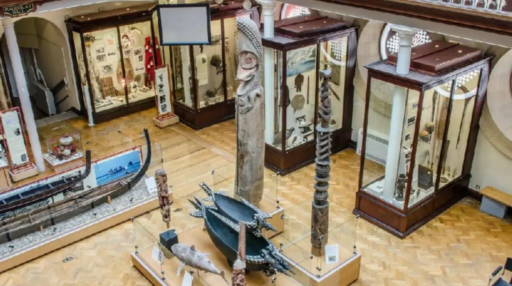
The Museum of Archaeology and Anthropology, located on Downing Street in central Cambridge, serves as the primary repository for physical assets excavated from Arbury. The museum curates and displays items that detail the daily lives of the Romano-British inhabitants.
Key exhibits include the Arbury stone coffin, intact pottery vessels, metal tools, and personal adornments such as bronze brooches. These objects receive professional conservation and remain accessible to academic researchers and the general public. The museum provides the essential visual and analytical context that connects the modern suburb of Arbury to its imperial past.
The Arbury Banks Earthwork Location
Arbury Banks refers to an ancient enclosure site situated near the northern periphery of Cambridge. Historically, this site featured a circular earthwork ditch and rampart system common to Iron Age defense and livestock management.
While urban housing and roads have altered the surface topography, sections of the ancient boundary survive as linear features and designated open spaces. Local heritage trails and council maps guide visitors along the paths that mirror these ancient boundaries. As you explore the modern site, you are crossing land with a deep heritage. Read about the full [Roman Cambridge and the Settlement of Duroliponte] to understand its origins.
Interpretive Signage and Public Trails
The Cambridge City Council, in partnership with local history societies, maintains a series of informational plaques and interpretation boards across Arbury. These installations stand in public parks, community centres, and along pedestrian paths.
The signs feature archaeological blueprints, artists’ reconstructions of Roman villas, and maps detailing the locations of major historical finds. This decentralized outdoor exhibit allows walking tourists to identify the exact coordinates where archaeologists unearthed Roman burials and farm buildings. The trails connect Arbury directly to the wider historical landscape of Castle Hill and the River Cam.
How did the Arbury Roman Coffin impact British archaeology?
The discovery of the Arbury Roman Coffin in 1953 provided exceptional evidence of high-status Romano-British burial practices and skeletal preservation. The find forced historians to re-evaluate the wealth, health, and social stratification of rural populations in Roman Cambridge.
The Discovery and Excavation of 1953
In August 1953, construction workmen operating near Arbury Road uncovered a massive, intact stone sarcophagus buried less than one metre below the surface. Archaeologists from the University of Cambridge immediately secured the site to conduct a systematic excavation.
The coffin was carved from a single block of Barnack limestone, a high-quality building stone quarried in Northamptonshire, roughly 60 kilometres away from Cambridge. The sheer weight and material of the sarcophagus indicated that the transport of the object required significant financial resources and logistics. The discovery altered the prevailing view that Arbury hosted only impoverished peasant farmers.
Bioarchaeological Analysis of the Remains
Inside the limestone sarcophagus, scientists found the well-preserved skeleton of a Roman woman aged between 40 and 45 years, alongside the remains of a young mouse. The skeletal preservation allowed modern bioarchaeologists to perform advanced laboratory tests, including stable isotope analysis and carbon dating.
| Metric / Analysis | Research Finding | Historical Implication |
|---|---|---|
| Material Origin | Barnack Limestone (Northamptonshire) | Significant wealth and access to long-distance trade networks. |
| Skeletal Age | Female, 40–45 years old | Reached full adulthood; indicative of a low-stress lifestyle. |
| Isotope Analysis | Low physical stress, high-protein diet | High social status; member of the landowning elite class. |
The results revealed that the woman enjoyed a diet rich in animal proteins and experienced minimal physical labor during her life. Her teeth showed low levels of wear compared to the average Romano-British peasant, confirming her elite status. The presence of the mouse skeleton suggested the coffin remained open for a brief period inside a burial vault before final sealing.
Impact on Romano-British Burial Studies
The Arbury coffin remains a landmark case study in British archaeology regarding rural pagan burial traditions during the late Roman Empire. Most rural burials in the region involved simple wooden coffins or shroud burials in earth graves.
The use of a monumental limestone sarcophagus proved the existence of an aristocratic landowning class residing permanently in the villas surrounding Duroliponte. This find allowed researchers to map the distribution of wealth across the Cambridgeshire fens and highlands. The preservation of the skeleton provided a reference standard for studying health, nutrition, and disease vectors in Roman Britain.
What did excavations reveal about the Arbury Iron Age enclosure?
Excavations revealed that the Arbury Iron Age enclosure was a large, fortified complex used for communal gatherings, livestock protection, and regional trade. The site featured substantial defensive ditches, timber palisades, and internal structures indicating long-term seasonal or permanent occupation.
Structural Design and Engineering
Archaeological trenches cut across the Arbury enclosure revealed a sophisticated ringwork design dating to the Middle and Late Iron Age. The primary enclosure wall consisted of a V-shaped ditch measuring up to 5 metres wide and 2.5 metres deep.
The builders threw the excavated earth inward to create a high rampart bank, which they reinforced with heavy timber palisades. This engineering required the coordinated labor of hundreds of individuals, which indicates a highly organized tribal structure. The enclosure layout matches other regional hillforts and ringworks across East Anglia, such as Wandlebury Ring and Cherry Hinton.
Domestic and Economic Activities
Inside the defensive perimeter, archaeologists discovered evidence of intensive domestic and economic operations. Posthole alignments indicate the presence of multiple large roundhouses constructed from wattle and daub with thatched roofs.
Storage pits, designed to preserve grain over winter, yielded charred seeds of spelt wheat and barley. The discovery of loom weights made of fired clay and iron slag confirms that the inhabitants practiced textile weaving and small-scale metallurgy on-site. These findings show that the enclosure functioned as a self-sustaining economic community during periods of peace.
Strategic and Ritual Function
The Arbury enclosure served a dual purpose as a strategic defensive stronghold and a ceremonial center for the local population. Its location allowed the community to control the movement of cattle across the low-lying pastures near the River Cam.
Excavations within the ditch terminals uncovered deliberate deposits of complete pottery vessels, animal skulls, and metalwork. Archaeologists classify these items as ritual or votive offerings placed during the construction or decommissioning of the fort. This evidence proves that the enclosure held deep social and religious meaning for the Iron Age tribes before the Roman arrival.
How did Roman roads shape the development of Arbury
Roman roads shaped Arbury by establishing permanent trade corridors that connected local agricultural producers to regional and national markets. The infrastructure dictated the alignment of field systems, the positioning of villas, and the rapid movement of goods.
The Course of Akeman Street
Akeman Street represents the primary Roman road influencing the topography of northern Cambridge and Arbury. This major imperial highway ran from Verulamium (St Albans) through Duroliponte (Cambridge) and continued northeast toward the Norfolk coast.
The road sliced directly along the western margins of Arbury, featuring a metalled surface constructed of compacted gravel, flint, and chalk layered over a raised embankment known as an agger. The construction of this durable, all-weather highway allowed wagons to transport heavy agricultural yields from Arbury to urban markets without risk of bogging down in winter mud.
Infrastructure Expansion and Land Division
The installation of Akeman Street caused a complete reorganization of the Arbury landscape. Roman surveyors established a grid-like system of drainage ditches and field boundaries that ran parallel or perpendicular to the highway.
This layout maximized irrigation efficiency and simplified land registry for taxation purposes. Farmers built their homesteads, barns, and kilns directly alongside the secondary tracks branching off the main road. The infrastructure allowed for the rapid expansion of commercial farming, replacing the irregular, localized field shapes of the pre-Roman era.
Economic Integration with the Empire
The proximity of Arbury to a major imperial transit route allowed local farmers to transition from subsistence agriculture to surplus commercial production. Wagons carried grain, hides, and livestock south to London or north to the military outposts near the Wash.
The return journey brought imported luxury goods into Arbury homes, including olive oil from Hispania, fish sauce from the Mediterranean, and fine pottery from Gaul. The physical road network acted as the mechanism that integrated this Cambridgeshire countryside into the broader socio-economic fabric of the Roman Empire.
What role did farming play in ancient Arbury?
Farming played the central economic role in ancient Arbury, serving as the primary source of food, wealth, and trade commodities for the region. The fertile soils supported advanced crop cultivation and large-scale animal husbandry that sustained the nearby town of Duroliponte.
Arable Cultivation and Crop Techniques
The ancient inhabitants of Arbury exploited the rich, well-drained gravel soils to cultivate a variety of hardy cereal crops. Farmers relied heavily on spelt wheat and six-row barley, which resisted the damp conditions of the nearby Fen edge.
During the Roman period, agriculturalists introduced the heavy iron-tipped plow, known as the carruca, which turned the soil deeper than the older prehistoric ards. This technological shift allowed for more intensive cultivation, leading to higher crop yields. The community also cultivated legumes, such as peas and field beans, which provided human nutrition and replenished nitrogen levels in the soil fields.
Animal Husbandry and Livestock Management
Livestock management formed the second pillar of the Arbury agricultural economy. Analysis of animal bones recovered from historical refuse pits reveals a sophisticated animal management strategy.
Cattle represented the most valuable livestock, providing the draft power needed to pull heavy plows, while also supplying milk, beef, and leather. Sheep populations provided wool for clothing production and mutton for consumption. The presence of specialized butchery marks on bones suggests that Arbury farmers operated commercial slaughterhouses to supply meat directly to the urban population of Duroliponte.
Storage, Processing, and Distribution
To handle surplus agricultural outputs, the residents of ancient Arbury constructed specialized processing facilities across the landscape. Excavations have revealed corn-drying kilns built from flint and tile, which dried grain before long-term storage to prevent rotting and spoilage.
Large timber granaries raised on staddle stones protected harvested crops from moisture and vermin. Once processed, workers packed the grain into sacks or baskets for transport along Akeman Street. This organized supply chain established Arbury as a vital breadbasket for the civilian and administrative populations living around the Cambridge Castle Hill fort.
Why should modern travellers visit Cambridge’s northern suburbs
Modern travellers should visit Cambridge’s northern suburbs to experience a preserved, multi-layered historical landscape that offers a quiet alternative to the crowded city centre. The area combines authentic archaeological sites with accessible educational resources and diverse local amenities.
A Deeper Historical Perspective

While central Cambridge attracts millions of tourists annually for its medieval and university architecture, the northern suburbs like Arbury offer immediate access to the region’s ancient foundations. Visiting this area allows history enthusiasts to explore the roots of human settlement in Cambridgeshire, dating back thousands of years before the university colleges were established.
The geography provides a clear view of how landscape topography, water sources, and Roman engineering dictated the development of the modern city. It offers a raw, authentic look at Britain’s development from tribal chiefdoms to an integrated Roman province.
Off-the-Beaten-Path Leisure and Work Hubs
For digital nomads, business travellers, and leisure tourists, Arbury provides an authentic community atmosphere with practical modern advantages. The area features numerous public parks, community hubs, and work-friendly cafes equipped with high-speed internet and quiet seating areas.
Visitors can balance remote work commitments with historical exploration, avoiding the high prices and dense crowds of the central business district. The proximity to the Cambridge Science Park and the guided busway makes the northern suburbs highly accessible for domestic and international travellers alike.
Practical Travel Tips for Heritage Tourists
Tourists planning a visit to Arbury can easily integrate the trip into a broader Cambridge itinerary. The area sits a short 15-minute bicycle ride or a brief bus journey from the city centre along the Histon Road or Milton Road corridors.
The best approach involves starting at the Museum of Archaeology and Anthropology to examine the physical artefacts, followed by a walking or cycling tour of Arbury’s parks and interpretive trails. This combination of indoor museum curation and outdoor landscape exploration provides a thorough understanding of Cambridge’s ancient origins.
FAQs About Ancient History in Arbury
What archaeological evidence proves Romans lived in Arbury?
Excavations in Arbury have uncovered significant physical evidence, including a monumental limestone coffin, domestic pottery, and coins dating from the 1st to 4th centuries AD. Archaeologists also discovered extensive networks of Roman drainage ditches and trackways that aligned with nearby imperial roads. These findings confirm that the area was a highly active agricultural and residential suburb supporting the Roman town of Duroliponte.
Can you still see the physical boundaries of the Arbury Iron Age enclosure today?
While modern housing developments and roads have significantly altered the surface topography, parts of the ancient enclosure still influence the local layout. Sections of the prehistoric ringwork boundary survive as linear features, designated open green spaces, and walking paths. The Cambridge City Council has also installed public interpretation boards along these routes to help visitors trace the exact coordinates of the ancient earthworks.
How did Akeman Street impact the ancient farmers of the Arbury region?
Akeman Street provided Arbury farmers with a durable, all-weather gravel highway that connected their fields directly to major imperial trade networks. This infrastructure allowed local agriculturalists to easily transport massive food surpluses to the urban market at Castle Hill and further across Roman Britain. The road also caused a complete reorganization of the landscape into highly efficient, rectangular farming plots.
Where are the artefacts discovered during the Arbury excavations currently located?
The vast majority of the physical assets, tools, and human remains excavated from Arbury are curated at the Museum of Archaeology and Anthropology on Downing Street in central Cambridge. The museum permanently houses high-status items like the intact Arbury stone sarcophagus, imported Samian pottery, and bronze brooches. These exhibits provide essential visual context for researchers and tourists looking to understand the area’s ancient past.
Why was the discovery of the Arbury stone coffin so important to British history?
The 1953 discovery of the Barnack limestone sarcophagus proved that high-status, wealthy individuals lived in the rural areas outside the main Roman fort. Bioarchaeological testing on the well-preserved female skeleton inside revealed that she enjoyed a high-protein diet and faced very little physical labor. This evidence forced historians to re-evaluate the social stratification of Roman Cambridge, confirming the presence of a wealthy landowning elite.