King’s Hedges in Cambridge carries a persistent reputation as one of the city’s rougher areas, often whispered about in local conversations and online forums. This image stems from decades of social and economic hurdles, though recent data and initiatives paint a more nuanced picture.
- Historical Roots of King’s Hedges
- Post-War Housing and Early Struggles
- Socio-Economic Challenges Today
- Crime Statistics and Perceptions
- The Lingering Stigma from Kingsway and Beyond
- Contrasting Cambridge’s Broader Prosperity
- Regeneration Efforts Underway
- Community Strengths and Resilience
- Future Outlook for King’s Hedges
Historical Roots of King’s Hedges
The area now known as King’s Hedges traces its origins to open land north of Cambridge called Albrach as early as the 13th century. In 1558, Richard Brakyn received permission to enclose 34 acres of this land, renaming it King’s Hedges, likely referencing ancient royal hunting grounds where hedges guided game for hunters.
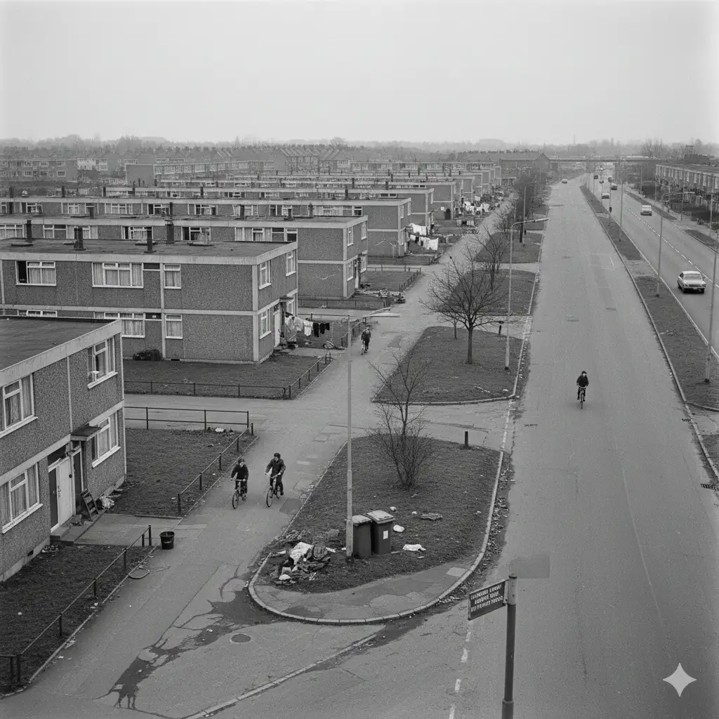
Development accelerated in the mid-20th century as Cambridge expanded to house growing populations relocated from aging city slums. Construction of the King’s Hedges estate began in 1967 northwest of Campkin Road, transforming a 125-acre site into 1,570 households by 1986, mostly low-rise blocks of three or four storeys.
Early residents, primarily working-class families from central Cambridge, faced immediate challenges including widespread vandalism and a stark absence of shops, schools, and community centers. This lack of infrastructure fostered isolation and bred early negative perceptions that echoed through generations.
Post-War Housing and Early Struggles
The estate’s design emphasized pedestrian and cycling paths, promoting car-free movement within the neighborhood—a forward-thinking approach unmatched in later Cambridge developments. Yet, good intentions clashed with reality as rapid construction prioritized quantity over quality.
By the 1970s and 1980s, King’s Hedges became synonymous with council housing issues plaguing post-war Britain: poor maintenance, overcrowding, and limited amenities. Local newspapers highlighted complaints about unkempt roads like King’s Hedges Road, once a private path burdening public funds.
These foundational problems sowed seeds of reputational damage. Families displaced from historic districts like Arbury brought diverse backgrounds, but without support services, tensions simmered. The area’s position on Cambridge’s northern fringe, near the A14, amplified feelings of detachment from the university-dominated city core.
Socio-Economic Challenges Today
King’s Hedges ranks among Cambridge‘s most deprived wards, with multiple Lower Super Output Areas (LSOAs) in the city’s lowest Indices of Multiple Deprivation (IMD) deciles. Income and employment deprivation affect over 22% of residents, compounded by barriers in education, health, and housing.
Cambridge’s stark inequality exacerbates this: as the UK’s most unequal city despite its prosperity, high housing costs average rents at £950 monthly squeeze low-income households. King’s Hedges sees elevated food poverty, with reliance on food banks rising steadily.
Unemployment lingers higher than city averages, alongside lower educational attainment. While Cambridge boasts world-class universities, wards like King’s Hedges grapple with skills gaps, fueling cycles of low-wage work and benefit dependency. These metrics underpin the “rough” label, even as the city thrives.
Crime Statistics and Perceptions
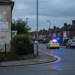
Crime rates in King’s Hedges stand at 116 per 1,000 residents annually medium compared to national wards but elevated for affluent Cambridge. Streets like King’s Hedges Road report 90 crimes per 1,000, 19% above the local Arbury average, driven by violence (50 per 1,000) and shoplifting hotspots near supermarkets.
Violent offenses rose 90% year-over-year in some spots, though overall crime has fallen 45% over the past decade. Anti-social behavior and criminal damage persist, often linked to specific sites like Kingsway flats, decried as “sketchy” in forums.
Perceptions outpace reality: Reddit users note the area’s working-class and immigrant demographics clash with Cambridge’s elite image, perpetuating stigma from 20-year-old incidents like open drug dealing. What seems average nationally feels gritty amid Porsche-lined streets elsewhere.
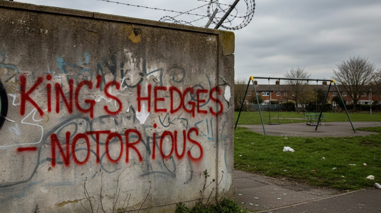
The Lingering Stigma from Kingsway and Beyond
Kingsway estate exemplifies reputational anchors aging council flats plagued by structural decay, damp, fire risks, and falling concrete from balconies. Residents report feeling unsafe, with anti-social behavior unchecked due to underinvestment.
This site, alongside Arbury Court, draws complaints of unfit housing too costly to repair. Problem families involved in drugs and violence amplify tales, as locals recall uni-era dealers and pub brawls from decades past. Reputations endure, deterring buyers despite cheaper homes.
Social media and word-of-mouth cement this: King’s Hedges is “rough for Cambridge,” viewed warily by newcomers. Yet, many long-term residents report no personal trouble, highlighting how outdated narratives overshadow daily life.
Contrasting Cambridge’s Broader Prosperity
Cambridge’s global acclaim for innovation at the Science Park adjacent to King’s Hedges underscores the irony. While the city ranks prosperous (IMD average score 66th percentile nationally), pockets like this ward highlight inequality.
University wealth and tech boom drive house prices 16 times average earnings, pricing out locals. King’s Hedges absorbs spillover: diverse populations from global migrants sustain vibrancy but fuel biases against “council estate” living.
This disparity breeds resentment. Private school elites view the area through a lens of class divide, ignoring its cycling-friendly paths and community pubs like The Ship. The reputation problem is as much perceptual as factual.
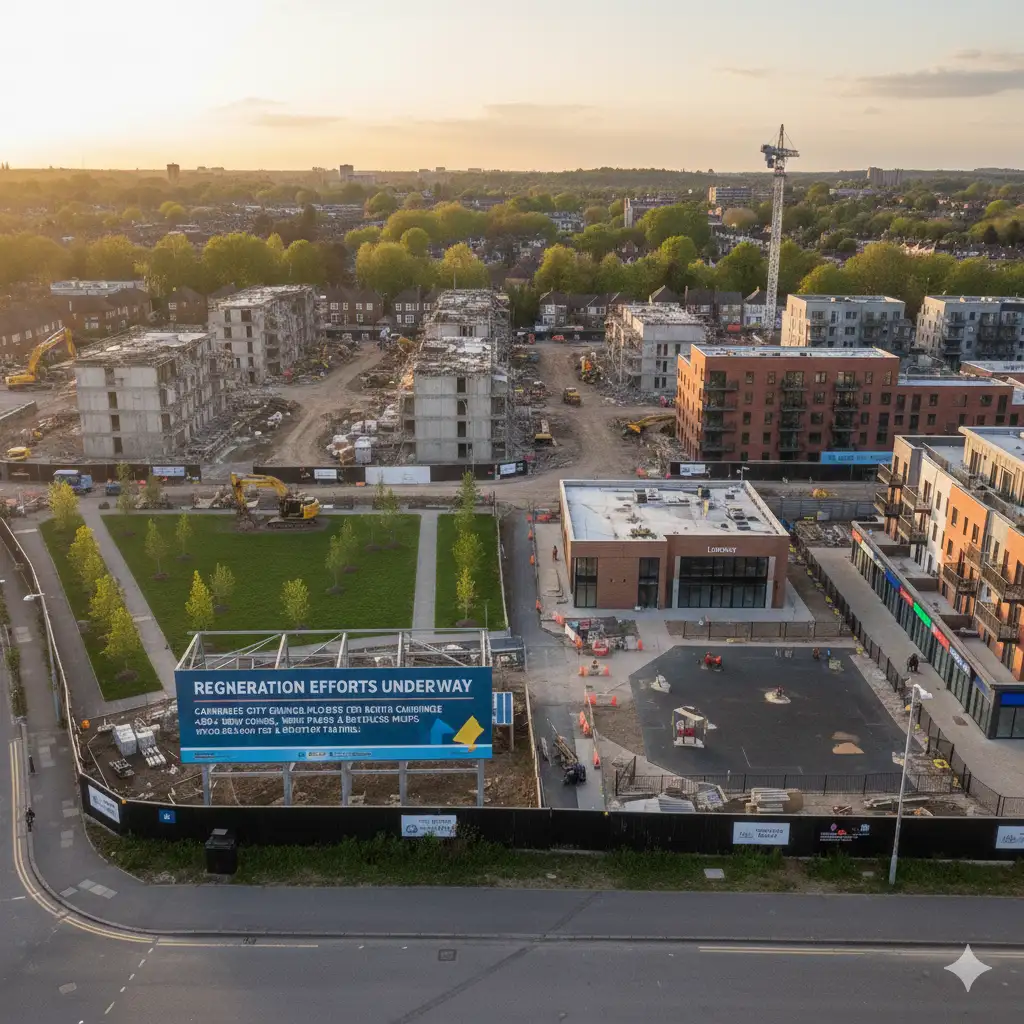
Regeneration Efforts Underway
Cambridge City Council pledges £80 million for north Cambridge, targeting King’s Hedges via the North Cambridge Framework for Change. Plans demolish 149 unfit flats at Kingsway, Arbury Court, and Brackley Close, replacing them with 400+ homes: 200+ council units and market-rate properties.
Kingsway regeneration includes 99 council homes, 98 private ones, and a new park tackling open-space woes. Arbury Court gets a library, playground, and revamped shops, addressing anti-social behavior through better public realms.
Consultations since May 2025 shaped these, with residents prioritizing safety and facilities. Council leader Gerri Bird emphasizes life-changing investment in deprived areas, supporting displaced tenants with tailored rehousing.
Community Strengths and Resilience
Beyond headlines, King’s Hedges boasts assets like King’s Hedges Primary School (1967) and The Grove Primary, fostering local education. Cambridge Regional College offers skills training, countering deprivation.
Guided Busway access since 2011 links to the city center and Science Park jobs. Pubs and shops build social fabric, while pedestrian designs encourage active lifestyles. Residents highlight unity, from anti-closure campaigns to modern diversity.
Initiatives like credit unions, digital skills classes, and affordable housing combat poverty. Free swimming for low-income kids and cookery programs boost health, proving community-driven change.
Future Outlook for King’s Hedges
As demolition and rebuilding progress into 2026, King’s Hedges stands at a tipping point. Successful regeneration could erase outdated stigmas, blending modern homes with enhanced facilities. Crime trends downward, and IMD improvements signal hope.
Yet, challenges persist: ensuring inclusive growth amid Cambridge’s housing crisis demands vigilance. If council delivers on promises, the ward’s reputation may shift from problem child to resilient success story.
Property values could rise with parks and shops, attracting families beyond stereotypes. The area’s history from medieval hedges to post-war haven reminds that reinvention defines Cambridge. King’s Hedges, long misunderstood, edges toward brighter days.