The River Cam contains several peaceful locations that offer quiet retreats away from urban congestion. These areas include Grantchester Meadows, Byron’s Pool, Paradise Local Nature Reserve, Coe Fen, and Ditton Meadows, each offering distinct natural environments for visitors.
- Why Is Grantchester Meadows Considered a Top Tranquil Spot?
- How Does Byron’s Pool Provide Solitude for Visitors?
- What Makes Paradise Local Nature Reserve a Hidden Sanctuary?
- Where Can You Find Quiet Spaces in Coe Fen and Sheep’s Green?
- Why Is Ditton Meadows an Ideal Escape on the Lower Cam?
- What is the quietest time of day to visit the River Cam?
- Can you walk along the entire River Cam from Cambridge to Grantchester?
- Are motorized boats allowed on the Upper Cam near Grantchester?
- Are dogs permitted in the peaceful nature reserves along the river?
- How do you access Byron’s Pool Local Nature Reserve?
The River Cam flows through Cambridgeshire in East Anglia, stretching over forty miles from its tributaries to its confluence with the Great Ouse. The waterway passes through historic urban areas, pastoral floodplains, and ecological conservation zones.
While central Cambridge experiences heavy boat traffic and tourism, sections upstream and downstream provide undisturbed natural habitats. These tranquil corridors preserve regional biodiversity while serving as accessible green spaces for outdoor recreation.
Geographically, the river divides into three distinct zones: the Upper Cam, the Backs, and the Lower Cam. The Upper Cam flows from Byron’s Pool through Grantchester, where strict conservation rules limit motorized river craft.
The Middle section includes the University of Cambridge college grounds, characterized by managed lawns and heavy punting activity. The Lower Cam extends northeast past Jesus Lock toward Fen Ditton, where rowing clubs operate alongside expansive public commons.
Quiet locations along the river exist due to historic land protection, environmental conservation policies, and vehicle access restrictions. Organizations such as Cambridge Past, Present & Future and the Cambridge City Council manage these riparian reserves. The presence of ancient flood meadows, wet woodlands, and low-density footpaths helps preserve calm environments across all seasons.
Why Is Grantchester Meadows Considered a Top Tranquil Spot?
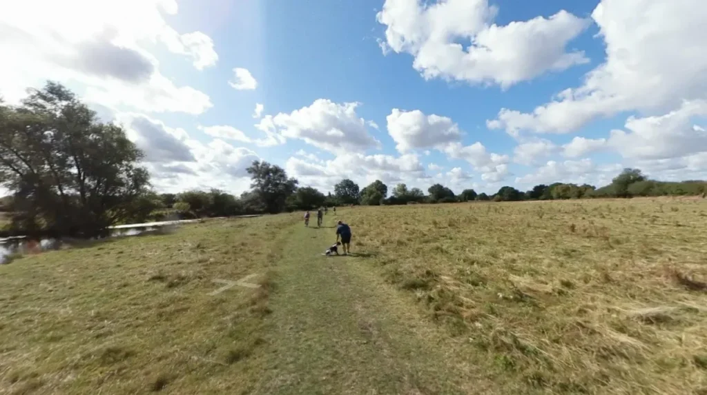
Grantchester Meadows provides fifty acres of protected floodplains along the Upper Cam, offering extensive walking paths, grazing fields, and undisturbed riverbanks. It maintains a peaceful environment through vehicle restrictions, agricultural traditions, and historical preservation measures.
Grantchester Meadows covers fifty acres of riverfront land positioned southwest of central Cambridge between Newnham and Grantchester village. The meadow system originated as common agricultural land during the medieval period and featured in the Domesday Book of 1086.
King’s College and the charity Cambridge Past, Present & Future jointly oversee the management of this terrain. The site remains free from permanent commercial development, retaining its historic pastoral layout.
The ecology of Grantchester Meadows includes floodplain grasslands, native willow trees, and damp chalk soils that support diverse wildlife. Native bird species, including kingfishers, grey herons, and barn owls, inhabit the river corridor.
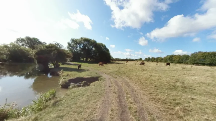
Red Poll cattle graze on the meadows during summer months to manage grass height without heavy mechanical equipment. This seasonal grazing method supports plant diversity and reduces soil compaction near the water line.
Visitors access the meadows via unpaved footpaths that run parallel to the River Cam. The area limits motorized transport, which eliminates traffic noise across the two-mile stretch.
Historical figures, including poet Rupert Brooke and members of the Bloomsbury Group, frequented the meadows during the early twentieth century for intellectual solitude. Today, the site serves as a quiet space for walking, reading, and low-impact nature observation.
How Does Byron’s Pool Provide Solitude for Visitors?
Byron’s Pool Local Nature Reserve offers quiet woodland pathways, a historic river weir, and shaded water margins. Located upstream from Grantchester, it limits crowds through its secluded location, dense canopy cover, and protected wildlife status.
Byron’s Pool sits on the River Cam near Trumpington, approximately three miles south of Cambridge city center. The site earned its name from Lord Byron, the Romantic poet who swam at the weir while studying at Trinity College between 1805 and 1808.
Cambridge City Council designated the 5.3-hectare site as a Local Nature Reserve to protect its riverine habitat. The reserve features a mix of mature broadleaf woodland, scrub, and open water structures.
The hydrologic structure of Byron’s Pool includes a sluice gate and weir system that regulates water levels along the Upper Cam. A modern fish pass allows migratory species like brown trout and European eels to move freely past the artificial barrier.
The surrounding woodland consists of mature crack willow, alder, and ash trees that absorb surrounding environmental noise. These trees create a shaded microclimate that maintains cool air temperatures throughout the summer.
The location experiences lower visitor volumes compared to urban parks because of its distance from main roads and public transport hubs. A circular pedestrian trail circles the pool, offering views of the river weir and surrounding woodland floor.
The reserve provides habitat for otters, bats, and wetland birds such as the daubenton’s bat and little grebe. The quiet nature of the site makes it suitable for wildlife recording, photography, and solitary walks.
What Makes Paradise Local Nature Reserve a Hidden Sanctuary?
Paradise Local Nature Reserve is a 2.2-hectare wet woodland featuring marshland plants, boardwalk footpaths, and mature willow trees. It provides a peaceful sanctuary within city limits by limiting visitor traffic through natural wetland barriers.
Paradise Local Nature Reserve occupies 2.2 hectares along the western bank of the River Cam in the suburb of Newnham. Managed by Cambridge City Council, this sanctuary contains one of the few remaining marshy wet woodlands, or carr, along the river system. The damp conditions prevented residential construction on the land during the nineteenth and twentieth centuries. Consequently, the area maintained its ancient wetland character despite surrounding urban expansion.
The ecosystem within Paradise Reserve depends on seasonal flooding from the adjacent River Cam. The soil remains waterlogged throughout much of the year, fostering the growth of large-leaved butterbur plants and aquatic mosses. The site hosts the rare musk beetle, an insect species dependent on old, decaying willow trees for larval development. Fallen timber and standing deadwood are preserved intentionally to support saproxylic insects and fungi.
Visitors navigate Paradise Reserve using elevated wooden boardwalks that cross the marshy ground without disrupting plant roots. The reserve maintains a dense canopy cover that filters ambient traffic sound from nearby roads. Bench seating along the water’s edge provides quiet viewports facing the undisturbed river channel. Because the wet ground deters large gatherings and group sports, the reserve remains a calm venue for wildlife observation.
Where Can You Find Quiet Spaces in Coe Fen and Sheep’s Green?
Coe Fen and Sheep’s Green offer quiet green spaces near central Cambridge with drainage ditches, cattle pastures, and tree-lined paths. These public commons maintain low noise levels by prohibiting commercial development and motor vehicles.
Coe Fen and Sheep’s Green form a connected expanse of historic floodplain commons located on the eastern and western banks of the River Cam, just south of Silver Street.
Historically used for grazing sheep and washing wool, these sites are protected under municipal common land conservation regulations. Small natural streams and historical drainage ditches intersect the terrain, creating isolated pockets of land surrounded by water.
The hydrology of these commons includes slow-moving side channels that run parallel to the main river stream. These channels create habitats for amphibians, including smooth newts and common frogs, as well as dragonfly nymphs. Mature pollarded willows line the banks, offering shelter for nesting waterfowl like moorhens and mallards. Grazing cattle move through Coe Fen during summer, preserving the traditional lowland meadow habitat.
Pedestrians can cross these commons via gravel pathways and footbridges that span the side streams. While the northern end of Sheep’s Green accommodates punters and swimmers near the Mill Pond, the southern sections remain quiet. The area acts as a buffer zone between city housing and countryside, offering peaceful views of historic church spires across green fields.
Why Is Ditton Meadows an Ideal Escape on the Lower Cam?
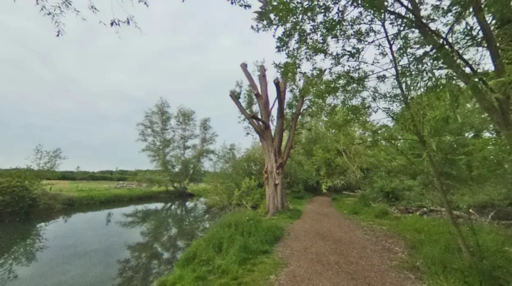
Ditton Meadows provides broad river views and open grazing land downstream from Cambridge. It serves as a quiet escape due to its location past the rowing boathouses, reduced punt traffic, and expanse of open riverbanks.
Ditton Meadows spans the eastern bank of the River Cam northeast of the city center, situated between Stourbridge Common and the village of Fen Ditton. Positioned along the Lower Cam, this meadow system offers expansive vistas of open countryside. The site rests outside the central tourist circuit, resulting in lower foot traffic compared to inner-city parks. It is accessible via the Chisholm Trail walking and cycling route.
The environment of Ditton Meadows features open floodplain grassland subject to tidal influences further downstream. Native flora includes wild buttercups, oxeye daisies, and meadowsweet, which flower across the fields during late spring. The lack of tall urban structures along the eastern riverbank allows for unimpeded wind movement and natural sunlight, creating an airy open setting.
The Lower Cam near Ditton Meadows carries larger river vessels, including traditional narrowboats and motorized barges, which move at low speeds. Unlike the central Backs, punting activity is absent along this section due to deeper water and stronger river currents. The meadows provide quiet spots along the riverbank for watching local rowing clubs train without the noise of city traffic.
What is the quietest time of day to visit the River Cam?
Early morning hours before 9:00 AM provide the quietest experience along the River Cam. During this time, foot traffic, tourist punting, and rowboat activities are minimal across all river sections.
Can you walk along the entire River Cam from Cambridge to Grantchester?
Yes, a continuous public footpath runs along the River Cam from the Cambridge Mill Pond through Coe Fen, Paradise Reserve, and Grantchester Meadows. The route covers approximately 2.5 miles of unpaved terrain.
Are motorized boats allowed on the Upper Cam near Grantchester?
Motorized watercraft are restricted on the Upper Cam upstream of Jesus Lock to preserve the ecosystem and maintain low noise levels. Only non-motorized vessels like punts, kayaks, and canoes may navigate these waters.
Are dogs permitted in the peaceful nature reserves along the river?
Dogs are permitted on public paths through Grantchester Meadows, Coe Fen, and Paradise Reserve. Pet owners must keep dogs on leashes near grazing cattle and protected wildlife nesting areas.
How do you access Byron’s Pool Local Nature Reserve?
Byron’s Pool is accessible via a dedicated car park off Grantchester Road in Trumpington. Visitors can also reach the reserve on foot via river footpaths leading south from Grantchester village.