A Chesterton Cambridge walk guide serves as an essential framework for exploring the deep structural evolution of northern Cambridge. The route follows the River Cam, connecting the ancient suburban parish of uk/local/chesterton/">Chesterton to the historic urban core at Quayside. Historically, this path transformed from an agricultural and Roman transit zone into a core industrial transport corridor during the nineteenth century.
- How Can You Navigate the Main Route of a Chesterton Cambridge Walk?
- What Key Historical Landmarks Will You Encounter Along the Trail?
- How Does the Chesterton Festival Enhance the Heritage Walk Experience?
- FAQs About Chesterton Cambridge Walk
- How long does it take to walk from Chesterton to Cambridge city centre along the river?
- Are there public toilets and food options available along the Chesterton river walk?
- Is the Chesterton to Cambridge riverside path suitable for bicycles and strollers?
- Can you access the Cambridge Museum of Technology directly from the towpath?
- What is the best parking location to access the historic Chesterton walk?
The background of Chesterton dates to the Domesday Survey of 1086, which recorded the area as a royal manor. The walk exposes pedestrians to architectural remnants from distinct eras, such as the fourteenth-century Chesterton Tower. This stone building functioned as a residential base for the procurator of the Abbey of Vercelli, an Italian institution granted the local church by King John in 1215. The path also crosses structural developments from the industrial era, including the old pumping station built in 1894, which now houses the Cambridge Museum of Technology.
The underlying mechanism of this route relies on the physical infrastructure of the River Cam towpath, which initially accommodated commercial horse-drawn barges. These barges hauled raw commodities, such as coal, timber, and grain, to the heart of the city. Today, the walk functions as a green commuter corridor and recreational trail that links diverse neighborhoods. Real-world examples of surviving historical features include the cast-iron bridges and concrete locks that controlled water flow. These structures enabled the rapid expansion of technology manufacturing companies along the northern river banks.
Economic data from industrial archives indicate that water-bound freight traffic peaked around 1850, right before railway expansions systematically altered local supply networks. Modern pedestrian surveys demonstrate the ongoing societal relevance of the route, recording over 2000 daily active users on peak weekend afternoons. The long-term implications of maintaining this path involve protecting urban green spaces from commercial development pressures while preserving local industrial heritage. Local preservation policies continue to protect these paths to ensure that future infrastructure integrations do not damage the historic footprint of the river corridor.
How Can You Navigate the Main Route of a Chesterton Cambridge Walk?
The primary trajectory of this walk requires following a defined sequence along the southern and northern banks of the River Cam. Navigating this linear pathway successfully requires starting at the northeastern edge of Chesterton and moving southwestward toward the city centre. Pedestrians must utilize dedicated footpaths, public pavements, and pedestrian bridges to ensure continuous movement along the waterway.
Step-by-Step Route Guide
1.Depart from Chesterton Recreation Ground:Distance: 0.0 km.
Begin the journey at the Pye Recreation Ground on Church Street, moving south toward the river along St Andrew’s Road to join the main towpath.
2.Cross the Equiano Bridge:Distance: 0.6 km.
Walk onto the modern Equiano Bridge to cross safely over the River Cam, observing the architectural design of the old Cambridge power station.
3.Pass Through Chesterton Lock:Distance: 1.2 km.
Follow the continuous towpath past the operational Chesterton Lock and weir system, where river houseboats and rowing skulls regularly congregate.
4.Traverse Jesus Green Pathway:Distance: 2.3 km.
Continue westward as the path opens into Jesus Green, tracking parallel to the famous college boathouses situated on the opposite northern bank.
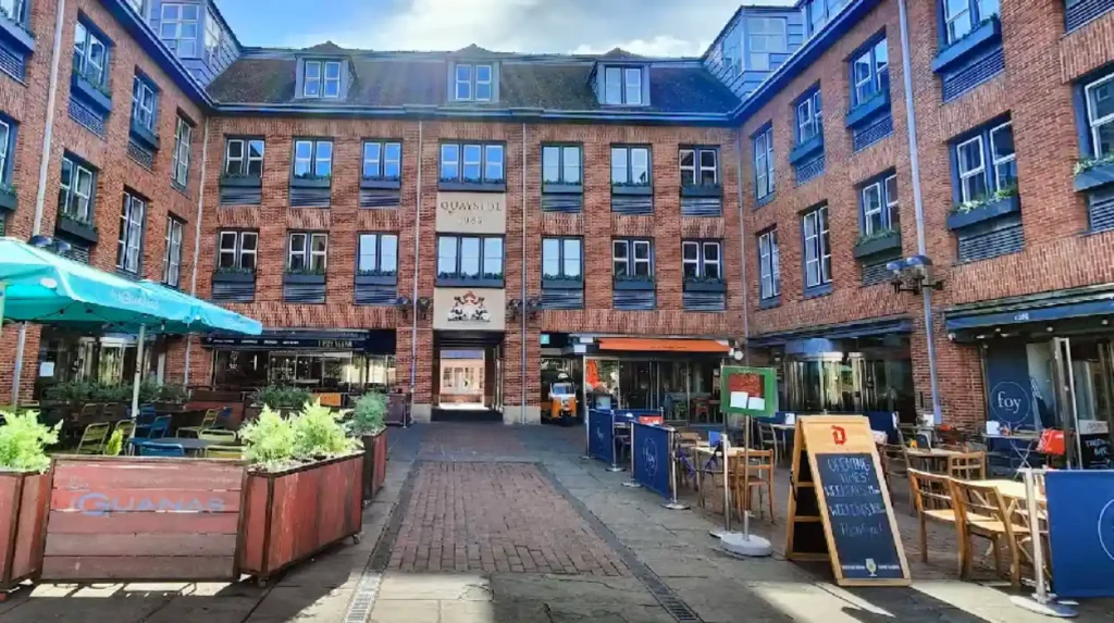
5.Arrive at Quayside:Distance: 3.2 km.
Terminate the walking route at the historic Quayside terrace, located adjacent to Magdalene Bridge, which marks the original commercial port area.
What Key Historical Landmarks Will You Encounter Along the Trail?
A comprehensive walk along this specific river stretch reveals an array of physical structures that signify the development of Cambridgeshire. These landmarks represent distinct architectural styles, corporate engineering initiatives, and municipal infrastructure projects spanning several centuries. Observing these locations provides direct insight into how the rural periphery of Cambridge integrated into the main academic and commercial center.
Major Landmark Profiles
- Chesterton Tower: A grade-one listed, two-story medieval stone building constructed entirely of flint and rubblework. It remains a rare surviving example of fourteenth-century ecclesiastical estate architecture within urban Cambridge.
- Cambridge Museum of Technology: Housed inside the Victorian-era sewage pumping station on Cheddars Lane, this site preserves local engineering artifacts. The structure features a large brick chimney built in 1894 that remains a dominant skyline feature.
- The College Boathouses: A collection of nineteenth and twentieth-century boathouses representing various University of Cambridge colleges, including Goldie Boathouse. These buildings exhibit distinct Victorian, Edwardian, and modernist architectural elements.
- The Equiano Bridge: A contemporary pedestrian bridge named after Olaudah Equiano, an influential abolitionist and writer who lived in Cambridgeshire during the eighteenth century. The bridge links newer residential sectors with old towpath routes.
The preservation of these specific structures relies heavily on national heritage listing frameworks and municipal conservation area designations. For instance, the historic pumping station underwent extensive structural restorations funded by a 2024 heritage lottery allocation to maintain wall integrity. These preservation efforts prevent the degradation of fragile materials, including early soft red bricks and cast-iron window frames, from intense weather exposure. Consequently, the trail functions as an open-air historical record that demonstrates structural evolution.
These physical sites provide definitive context regarding the historic wealth distribution and public health challenges of the region. The proximity of industrial processing plants to elite university rowing facilities reflects the historical socioeconomic stratification along the riverbanks. As walkers move from the industrial zones of Chesterton toward the university domains near Quayside, the architectural landscape shifts visibly. This spatial distribution highlights how the river historically accommodated both commercial labor and academic recreation.
How Does the Chesterton Festival Enhance the Heritage Walk Experience?

The annual Chesterton Festival fundamentally transforms the accessibility of this riverside route by introducing guided historical educational programming. Organized primarily by volunteers, local history societies, and industrial archaeology groups, the event delivers structured heritage walking options to the public. These educational sessions focus heavily on revealing the hidden narratives behind the physical infrastructure of the path.
Key Festival Components
- Guided Heritage Walks: Free 30-minute walking tours led by local historians departing from the designated information hub on Pye Recreation Ground. These tours utilize step-free pavement routes to maximize accessibility for all pedestrian cohorts.
- Industrial History Displays: Curated mobile exhibitions highlighting the regional impact of major companies, such as Pye, which advanced wireless radio development. These displays explain how local factories contributed significantly to twentieth-century radar and telecommunications systems.
- Community Engagement Hubs: Stalls organized by civic groups, including St Andrew’s Hall committees, which collect oral histories from long-term residents. These interactions help document the changing landscape of the river trail over the past decades.
The administrative mechanism of the festival relies on strict community-driven funding models and non-profit volunteer coordination frameworks. Stall booking fees remain tightly regulated, charging minor flat rates for informational spaces and small percentages on commercial food sales. This economic structure ensures that the event remains highly accessible to local civic groups and educational organizations. The festival occurs over a multi-day format during the month of June, attracting thousands of regional visitors to the Chesterton paths.
The long-term impact of this festival involves fostering deep community awareness regarding the vulnerability of local historical architecture. By directly guiding residents past threatened industrial landmarks, the tours generate public support for ongoing municipal conservation campaigns. These initiatives help prevent historic factory sites from being demolished or unsympathetically converted into modern corporate offices. The educational materials distributed during the walks continue to serve as reference resources for regional schools and academic researchers studying urban history.
FAQs About Chesterton Cambridge Walk
How long does it take to walk from Chesterton to Cambridge city centre along the river?
The 3.2-kilometer walking route from Chesterton to Quayside generally takes 40 to 50 minutes to complete at a standard walking pace. The pathway is flat and completely paved, making it easily manageable for pedestrians of varying fitness levels.
Are there public toilets and food options available along the Chesterton river walk?
Public facilities are located at Jesus Green, which features public toilets and a seasonal kiosk selling refreshments. Additionally, numerous historic pubs and local eateries operate immediately adjacent to the path near Chesterton and Quayside.
Is the Chesterton to Cambridge riverside path suitable for bicycles and strollers?
The entire route is step-free and utilizes wide, paved multi-use paths that easily accommodate strollers and bicycles. Pedestrians must remain aware of commuter cyclists who travel quickly along specific sections of the towpath.
Can you access the Cambridge Museum of Technology directly from the towpath?
Direct visual access to the museum buildings is available from the river path near Cheddars Lane. Physical entry to the interior exhibits requires walking around to the main entrance and purchasing a standard admission ticket.
What is the best parking location to access the historic Chesterton walk?
Ample paid parking is available at the Castle Hill car park and along Chesterton Road near the lock. Free parking options exist around the Chesterton Recreation Ground, though time restrictions apply during specific festival events.